The Great Polish Map of Scotland:
a geographer’s perspective
It is reasonable to speculate that our first attempt to draw a map was executed by scratching in the dirt with a stick to communicate some important information such as how to get from one place to another. This could conceivably have happened in the early stages of our evolution, predating formal language. We can further speculate that objects were later used to represent significant landscape features e.g. a small stone representing a hill-feature, thus incorporating the third dimension and creating a simple model. Ever since, both maps and models have played an important role in helping us to visualise and utilise landscape. Both maps and models hold an element of artistic endeavour – an early example of the effective fusion of technology and art that is now the hallmark of civilised man.

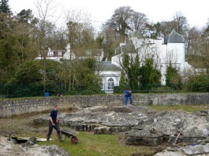
The article’s author Graham Little, seen here in the foreground, is a member of Mapa Scotland and former Head of Production at Ordnance Survey.
From a first brief encounter with the Great Polish Map in 1999, I started to develop a more intimate relationship with this remarkable structure in 2013. Situated on the opposite side of the gorge from Barony Castle in an egg-shaped enclosure, the Great Polish Map of Scotland is a truly unique feature. Is it a map or a topographic model? It is undoubtedly a model, if we define a map as a two-dimensional representation of landscape where height is suggested by cartographic techniques and/or textual information. It is certainly a landscape model with a difference as, when fully functioning, it not only includes the surrounding sea but also the major rivers in full flow! One of the many refurbishment challenges is to reactivate this hydrology.
The scale of the model is nominally 1:10,000 and the model’s horizontal dimensions are, with a couple of exceptions, within close tolerance of this scale. Incidentally 1:10,000 is the largest scale of Ordnance Survey mapping available for the whole of Scotland.
All published information to date describes a five times, at scale, vertical height exaggeration. Such licence is required for dramatic impact for without it Scotland, at 1:10,000 scale, would be disappointingly flat! At a five times height exaggeration, Ben Nevis grows from an at-scale height of 0.1344m to a model height of 0.672m, in effect elevating it from 1344m to 6720m – the altitude of a respectable Himalayan peak! However, the application of scale height exaggeration is somewhat inconsistent across the model. For example, from the ‘sea level’ datum (roughly the junction between the concrete base and the moulded cement superstructure) the model height of Ben Nevis is about 0.93m, a near seven times height exaggeration and the equivalent of a real world height of 9300 metres – significantly higher than Mount Everest! Goatfell, on Arran, does even better with a near eight times height exaggeration. Of course the horizontal scale of the mountains is also exaggerated, to avoid the vertical exaggeration giving them an unrealistic pinnacle-like appearance. So we have a Scotland that is very mountainous with little room left for low lying areas! Having said all that, one can only admire the modelling skills required to create such rich topographic detail using a very challenging medium.
Although a visitor to the Great Polish Map of Scotland cannot fail to be impressed by the audacity of the vision, they will quickly spot a couple of obvious quirks. The usual cartographic challenge of including the Orkney and Shetland Islands in their correct geographical locations in relation to mainland Scotland (many maps and atlases move them into an inset box for page formatting convenience) is neatly side-stepped by not including them at all! Some small islands have been aggregated to create larger ones and the Scottish mainland has become a near island with the Scottish-English border a southern ‘coastline’ – although two short walls linking the national border to the enclosure wall prevent the ‘sea’ from flooding in!
The natural south-north orientation of Scotland has been turned through 90 degrees to an east-west orientation to better suit the available site with the viewing platform sitting south of the Scottish border but on the east side of the model.
Google Earth gives us a bird’s eye view of the model and in some ways this plan view is even more impressive than the ground level perspective.
Four decades have elapsed since a team of young Polish geographers first started work on Jan Tomasik’s tribute to Scotland. Although the fabric of the model is in need of extensive refurbishment his vision has stood the test of time. The cynic could argue that the Great Polish Map of Scotland is just a bit of whimsy, serving no useful purpose. The response is emphatic – it is a fine homage to the wonders of geography and cartography, a celebration of landscape and a bridge between nations.
Graham E. Little, April 2014