January 2014, Restoration phase begins

The main aim in restoring the map is to ensure that it becomes a permanent feature in the Borders landscape and an educational resource and visitor attraction for future generations to admire and enjoy. The map is a physical testament to the historical and cultural links between the Scottish and Polish nations in the past, and its restoration expresses a belief in ties continuing in the future.
January 2014. Preparation of the foundation slab for new workshop.
-
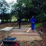
- Laying workshop foundation slabs
-
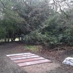
- Paving slabs in place for new workshop next to the map
-
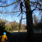
- Cutting branches from a tree over the site for a new workshop
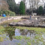
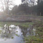
December 2013. Having secured our grant aid we have started on restoration work. Materials and equipment procurement is underway. Rubble and vegetation clearance continues. Repairs and improvement of the original water supply are almost complete.
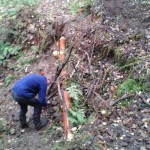
-
- Removing an old pipe
-
- New 160mm pipe section in place
-
- Landscaping the pipe repair.
-
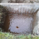
- Water intake screens
-
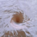
- Vortex thinks it’s in the southern hemisphere
-
- Tide rises in the Moray Firth
-
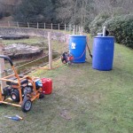
- Generator for pressure jet, and water tanks
-
- Your fly’s undone!
-
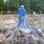
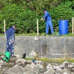
- Pressure blasting moss from the surface of the map
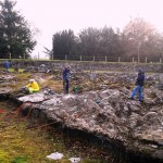
-
- Cleaning map surface
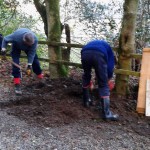
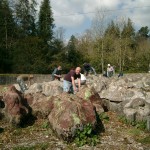
-
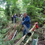
- Men at work
The Scottish National Trail

Scotland’s longest walking route, the 470-mile Scottish National Trail from Kirk Yetholm to Cape Wrath passes very close to the Great Map via the Old Post Road, about ½ mile from the map. A visit to the map forms an ideal lunch break (with bar snacks available at the hotel).
Learn more about the Trail here